mapsExploring Florida
 FL Maps > Region > 1760-1779 > Algemeene Kaart van de Westindische Eilanden., 1769
Site Map 

Algemeene Kaart van de Westindische Eilanden., 1769


Puzzle Directions: Click on a puzzle piece and drag it where you want it. When you connect two pieces correctly, they will join together. Mix up the pieces again. View finished map in pop-up window.

Title: Algemeene Kaart van de Westindische Eilanden.
Projection: Unknown
Source Bounding Coordinates:
W: 288 E: 318 N: 30 S: 10

Back to Map Page
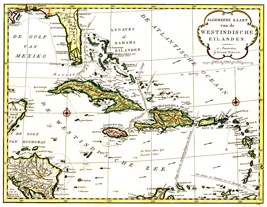
Description: Digitization provided by the USF Libraries Digitization Center. Rare Maps Collection: G4900 1769 .T57Notes from USF Library:A map of the Caribbean, also showing southern Florida, part of Yucatan and Honduras and Nicaragua. Major sea routes as well as the prevailing winds are given.Scale 1:3,000,000; (W 940--W 740/N 34030Õ--N 240).Measurements.Dimensions: 48 x 62 cm. on sheet 52 x 73 cm
Source: Izaak Tirion , (, : , 1769)
Map Credit: Courtesy of the Special Collections Department, University of South Florida.
SearchLicensePDF HelpGIS Help Google Earth Help Zoomify Help

 FL Maps > Region > 1760-1779 > Algemeene Kaart van de Westindische Eilanden., 1769