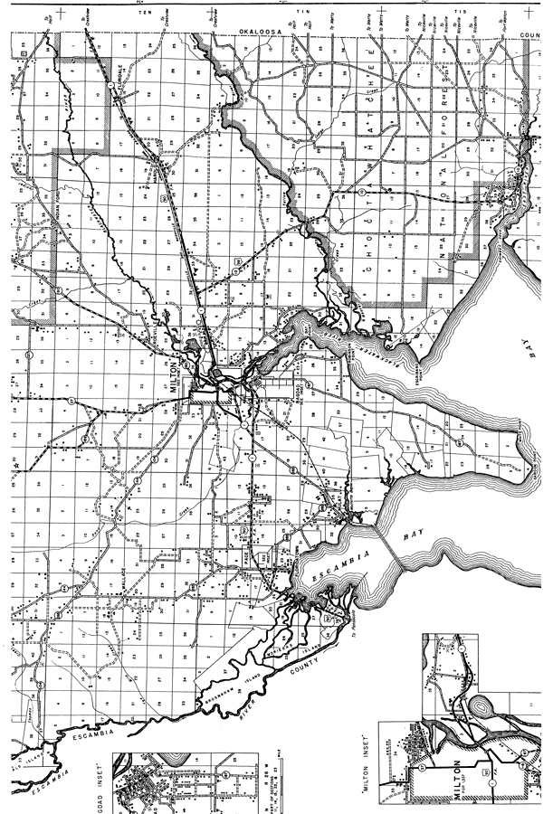
Description: This is a detailed map of the middle portion of the county of Santa Rosa in the state of Florida. Section Township Range (STR) is shown. This map shows all of the main cities, state roads, US Highways, railroads, county seat, bridge highways, tenant houses, cemeteries, churches, businesses, schools, airway beacon, factories, seasonal dwellings, camps, post offices, an airport, fire tower, farm units and dwellings other than farms. Key to Florida Highway maps.
Place Names: Santa Rosa, Wallace, Escambia River, Brosnaham Island, Pace, Milton, Roeville, Indian Ford, Harold, Floridale, Yellow River, Bay Point, Robinson Point, Bagdad, Mulat, Floridatown, Blackwater River, Escribano Point, Holly, Chimney Cove, Garcon Point, White Point
ISO Topic Categories: boundaries, transportation, location, inlandWaters
Keywords: Mid Santa Rosa, physical, political, transportation, physical features, major political subdivisions, local jurisdictions, roads, railroads, boundaries, transportation, location, inlandWaters, Poloconic, 1940
Source: , Florida State Road Department (, FL: , 1940)
Map Credit: Courtesy the private collection of Roy Winkelman. |
|