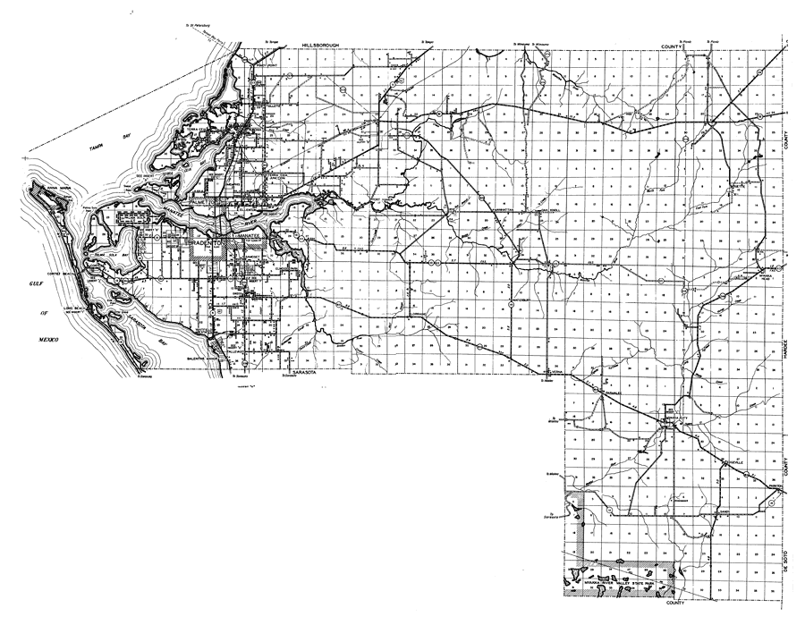
Description: This is a detailed map of the county of Manatee in the state of Florida. Section Township Range (STR) is shown. This map shows all of the main cities, state roads, US highways, bridge highways, drawbridge highways, federal aided highway, saw mills, railroads, inland waters, canals, ferries, corporate lines, county boundaries, county seat, airports, camps or lodges, post offices, emergency landing fields, golf courses, turpentine stills, cemeteries, forest ranger lookout station, seasonal dwellings, churches, farm units, dwellings other than farms, tenant houses, businesses, townhalls, hotels, schools, hospitals and factories. Key to Florida Highway maps.
Place Names: Manatee, Piney Point, Gillette, Terra Ceia, Rubonia, Terra Ceia Bay, Memphis, Duette, Oak Knoll, Manhattan, Fort Hamer, Parrish, Palmetto, Manatee River, Manatee, Palma Sola, Palma Sola Bay, Cortez, Bradenton, Elwood Park, Cortez Beach, Anna Maria, Tampa Bay, Gulf of Mexico, Oneco, Samoset, Lorraine, Waterbury, Myakka Head, Myakka City, Parmalee, Verna, Tallevast, Whitfield Estates, Balentine Manor, Sarasota Bay, Otter Island, Long Beach, Edgeville, Parkton, Sandy, Myakka River Valley State Park, Rye, Ellenton
ISO Topic Categories: boundaries, transportation, location, inlandWaters
Keywords: Manatee, physical, political, transportation, physical features, major political subdivisions, local jurisdictions, roads, railroads, boundaries, transportation, location, inlandWaters, Unknown,1940
Source: , Florida State Road Department (, FL: , 1940)
Map Credit: Courtesy the private collection of Roy Winkelman. |
|