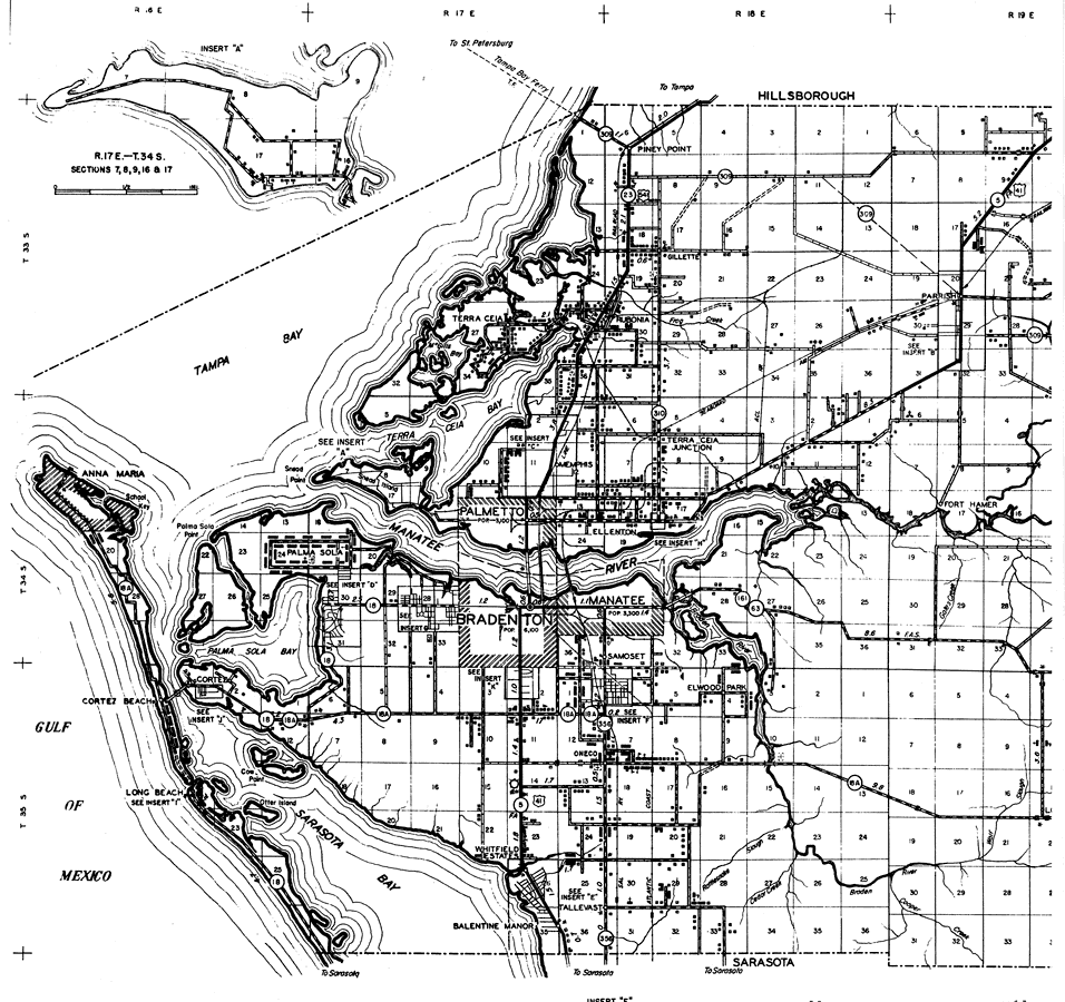
Description: This is a detailed map of the west portion of the county of Manatee in the state of Florida. Section Township Range (STR) is shown. This map shows all of the main cities, state roads, US highways, bridge highways, county seat, tenant houses, churches, schools, cemeteries, businesses, post offices, citrus packinghouses, camps, emergency landing field, seasonal dwellings, sawmills, golf courses, an airport, farm units and dwellings other than farms. Key to Florida Highway maps.
Place Names: Manatee, Piney Point, Gillette, Terra Ceia, Rubonia, Terra Ceia Bay, Memphis, Palmetto, Ellenton, Parrish, Fort Hamer, Tampa Bay, Manatee River, Gulf of Mexico, Palma Sola, Palma Sola Point, Bradenton, Manatee, Palma Sola Bay, Anna Maria, Cortez, Cortez Beach, Long Beach, Sarasota Bay, Oneco, Whitfield Estates, Elwood Park, Samoset, Tallevast, Balentine Manor
ISO Topic Categories: boundaries, transportation, location, inlandWaters
Keywords: West Manatee, physical, political, transportation, physical features, major political subdivisions, local jurisdictions, roads, railroads, boundaries, transportation, location, inlandWaters, Unknown,1940
Source: , Florida State Road Department (, FL: , 1940)
Map Credit: Courtesy the private collection of Roy Winkelman. |
|