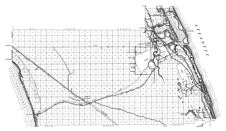
Description: This is a detailed map of the county of Martin in the state of Florida. Section Township Range (STR) is shown. This map shows all of the main cities, state roads, US highways, bridge highways, drawbridge highways, federal aided highway, saw mills, railroads, inland waters, canals, ferries, corporate lines, county boundaries, county seat, airway beacons, airports, camps or lodges, post offices, emergency landing fields, turpentine stills, cemeteries, forest ranger lookout station, seasonal dwellings, churches, farm units, dwellings other than farms, tenant houses, businesses, townhalls, hotels, schools, hospitals and factories. Key to Florida Highway maps.
Place Names: Martin, Indian River, Stuart, Jensen, Rio, Sewalls Point, Port Sewall, Palm City, St. Lucie Inlet, Atlantic Ocean, Hanson Grant, Salerno, Fruita, Everglades, Lake Okeechobee, Indian Town, Hobe Sound, Trapper's Zoo, Port Mayaca, Gomez, Indiantown, Sewall's Point, St. Lucie River
ISO Topic Categories: boundaries, transportation, location, inlandWaters, oceans
Keywords: Martin, physical, political, transportation, physical features, major political subdivisions, local jurisdictions, roads, railroads, water routes, boundaries, transportation, location, inlandWaters, oceans, Unknown,1936
Source: , Florida State Road Department (, FL: , 1936)
Map Credit: Courtesy the private collection of Roy Winkelman. |
|