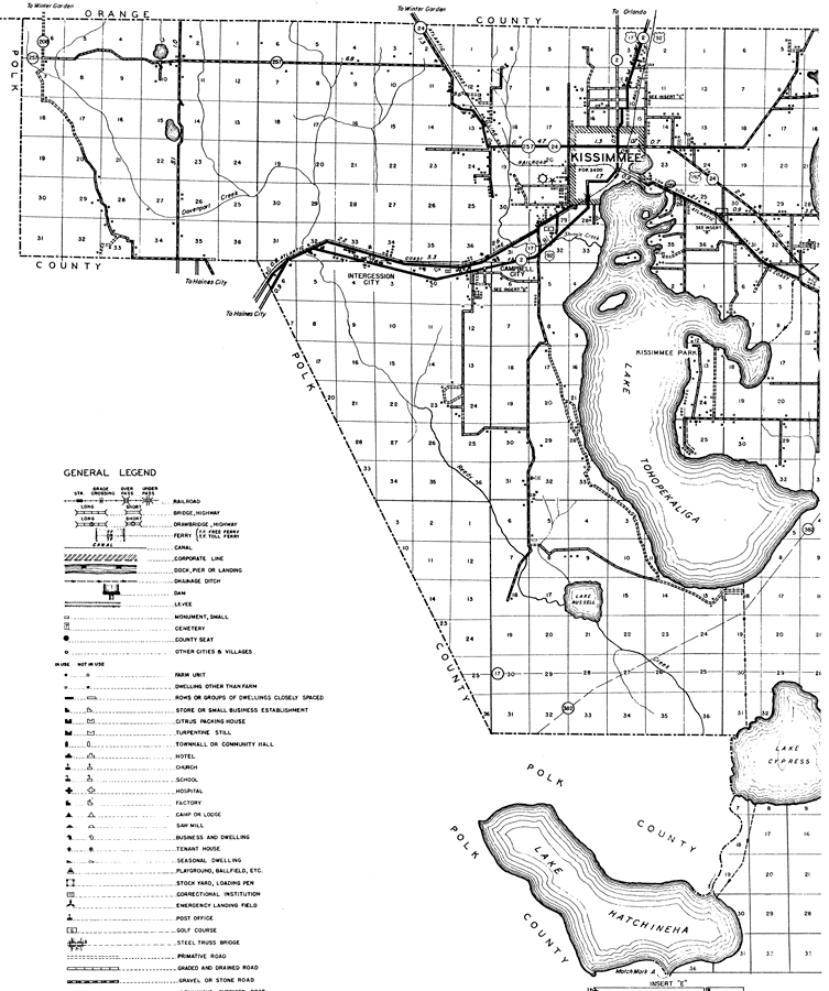
Description: This is a detailed map of the west portion of the county of Osceola in the state of Florida. Section Township Range (STR) is shown. This map shows all of the main cities, state roads, US highways, bridge highways, county seat, air beacon, airport, businesses, churches, cemeteries, camps, hotels, a school, a post office, farm units and dwellings other than farms. Key to Florida Highway maps.
Place Names: Osceola, Intercession City, Campbell City, Kissimmee, Kissimmee Park, Lake Tohopekaliga, Lake Russell, Lake Cypress, Lake Hatchineha
ISO Topic Categories: boundaries, transportation, location, inlandWaters
Keywords: West Osceola, physical, political, transportation, physical features, major political subdivisions, local jurisdictions, roads, railroads, boundaries, transportation, location, inlandWaters, Mercator, 1936
Source: , Florida State Road Department (, FL: , 1936)
Map Credit: Courtesy the private collection of Roy Winkelman. |
|