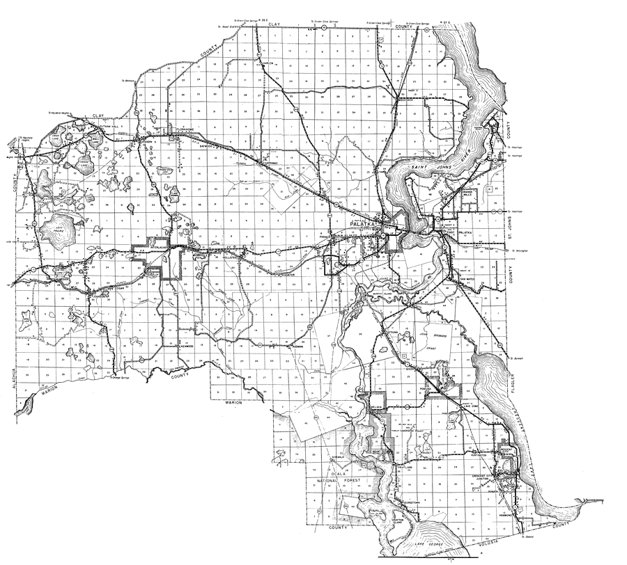
Description: This is a detailed map of the county of Putnam in the state of Florida. Section Township Range (STR) is shown. This map shows all of the main cities, state roads, US highways, bridge highways, drawbridge highways, federal aided highway, saw mills, railroads, inland waters, canals, ferries, corporate lines, county boundaries, county seat, airway beacons, airports, camps or lodges, post offices, emergency landing fields, turpentine stills, cemeteries, forest ranger lookout station, seasonal dwellings, churches, farm units, dwellings other than farms, tenant houses, businesses, townhalls, hotels, schools, hospitals and factories. Key to Florida Highway maps.
Place Names: Putnam, Putnam Hall, Goose Lake, Wall Lake, Swan Lake, Grandin, Florahome, Baywood, Carraway, Harlem, Bostwick, Federal Point, St. Johns River, Saint Johns River, Orange Mills, Palatka, East Palatka, Hunter, Hollister, Mannville, Interlachen, Keuka, Edgar, Johnson, Levy Prairie, McMeekin, Kenwood, Rodman, Oklawaha River, Murphy Island, Satsuma, Sisco, John Broward Grant, Pomona, San Mateo, Lake Como, Welaka, Norwalk, Mount Royal, Fruitland, Georgetown, Hog Island, Drayton Island, Crescent City, Denver, Huntington, Hammond, Crescent Lake, Lake George, Francis, Melrose
ISO Topic Categories: boundaries, transportation, location, inlandWaters
Keywords: Putnam, physical, political, transportation, physical features, major political subdivisions, local jurisdictions, roads, railroads, boundaries, transportation, location, inlandWaters, Unknown,1936
Source: , Florida State Road Department (, FL: , 1936)
Map Credit: Courtesy the private collection of Roy Winkelman. |
|