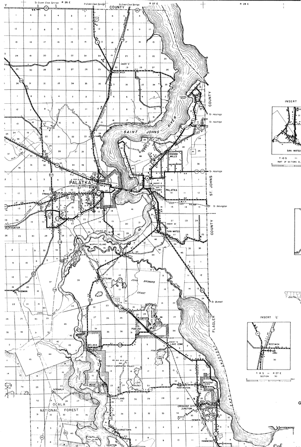
Description: This is a detailed map of the northeast portion of the county of Putnam in the state of Florida. Section Township Range (STR) is shown. This map shows all of the main cities, state roads, US highways, bridge highways, railroads, county seat, businesses, tenant houses, emergency field, schools, cemeteries, churches, camps, townhall, an airport, turpentine stills, forest ranger lookout station, a post office, farm units and dwellings other than farms. Key to Florida Highway maps.
Place Names: Putnam, Saint Johns River, Bostwick, Federal Point, Orange Mills, Palatka, Francis, Hunter, East Palatka, San Mateo, Murphy Island, Seven Sister Islands, Rodman, Sisco, Satsuma, John Broward Grant, Pomona, Lake Como, Crescent City, Crescent Lake, Huntington, Mount Royal, Welaka, Norwalk, Fruitland, Georgetown, Drayton Island, Hog Island, Hammond, Denver
ISO Topic Categories: boundaries, transportation, location, inlandWaters
Keywords: Northeast Putnam, physical, political, transportation, physical features, major political subdivisions, local jurisdictions, roads, railroads, boundaries, transportation, location, inlandWaters, Unknown,1936
Source: , Florida State Road Department (, FL: , 1936)
Map Credit: Courtesy the private collection of Roy Winkelman. |
|