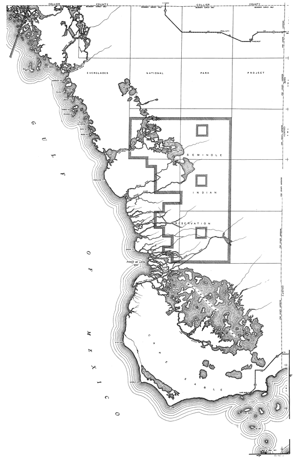
Description: This is a detailed map of the third portion of the county of Monroe in the state of Florida. Section Township Range (STR) is shown. This map shows all of the main keys and cities, state roads, bridge highways, businesses and dwellings other than farms. Key to Florida Highway maps.
Place Names: Monroe, Hudson River, Chatham River, Pavilion Key, Duck Rock, Oyster Bay, Trail City, Pinecrest, Alligator Bay, Mormon Key, Mosquito Key, Snake Key, Clam Pt, Turkey Key, Plover Key, Alligator Cove, Alligator Pt, Gulf of Mexico, Wood Key, Bird Key, Big Lostmans Bay, First Bay, Lostmans River, Second Bay, Highland Pt, Broad River, Rogers River, Seminole Indian Reservation, Shark Pt, Ponce De Leon Bay, Whitewater Bay, Cape Sable, Oyster Keys, Clive Key, Man O' War Key, East Cape, Middle Cape, N. W. Cape
ISO Topic Categories: boundaries, transportation, location, inlandWaters, oceans
Keywords: Monroe 3, physical, political, transportation, physical features, major political subdivisions, local jurisdictions, roads, boundaries, transportation, location, inlandWaters, oceans, Mercator, 1937
Source: , Florida State Road Department (, FL: , 1937)
Map Credit: Courtesy the private collection of Roy Winkelman. |
|