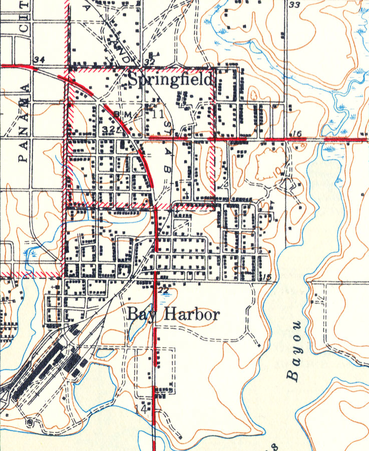
Description: A portion of the Parker Quadrangle showing details of Springfield and Bay Harbor, Florida. The map shows man made structures such as State, primary, and secondary roads, railroad routes and the train depot, as well as various buildings including residences, churches, schools, et cetera. Natural features include rivers, bayous, and wetlands. Contour lines are shown at 10-foot intervals and show both positive and negative surface features. The map is from the USGS 7 1/2-minute series, with a map scale of 1:31,680. The Township/Range grid based on the Tallahassee baseline and meridian is shown.
Place Names: Bay, Springfield, Bay Harbor
ISO Topic Categories: boundaries, transportation, inlandWaters, elevation
Keywords: Springfield and Bay Harbor, Florida, physical, political, transportation, physical features, topographical, local jurisdictions, roads, railroads, boundaries, transportation, inlandWaters, elevation, Polyconic, 1945
Source: , Parker Quadrangle (Washington, DC: United States Department of the Interior Geological Survey, 1945)
Map Credit: Courtesy the private collection of Roy Winkelman |
|