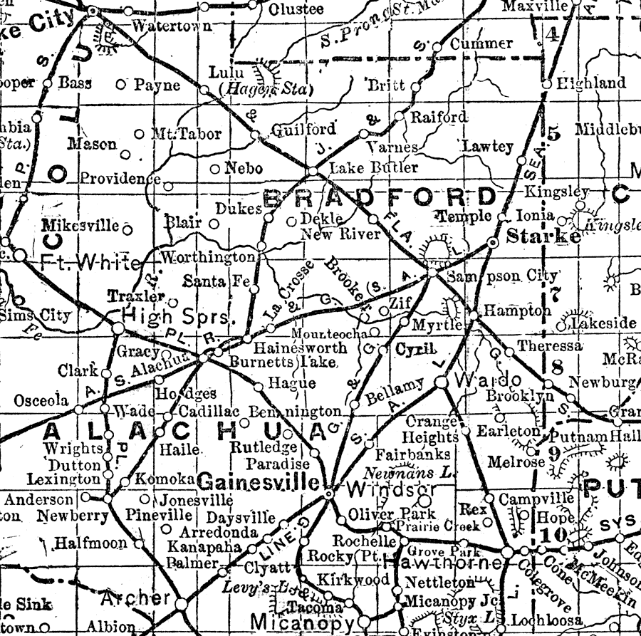
Description: This is a detail of Bradford County from a portion of the State of Florida map showing the county seat, great cities, big towns, important villages, little villages and stations. Style of lettering indicates the character and relative importance of place. Scale: 21 miles to 1 inch. Longitude is measured from Greenwich at the top of the map, and from Washington at the bottom of the map. The Township/Range grid based on the Tallahassee baseline and meridian is shown.
Source: R. G. Dun, The Mercantile Agency Reference Book Vol. 138 (New York, NY: R. G. Dun & Co., 1902)
Map Credit: Courtesy the private collection of Roy Winkelman. |
|