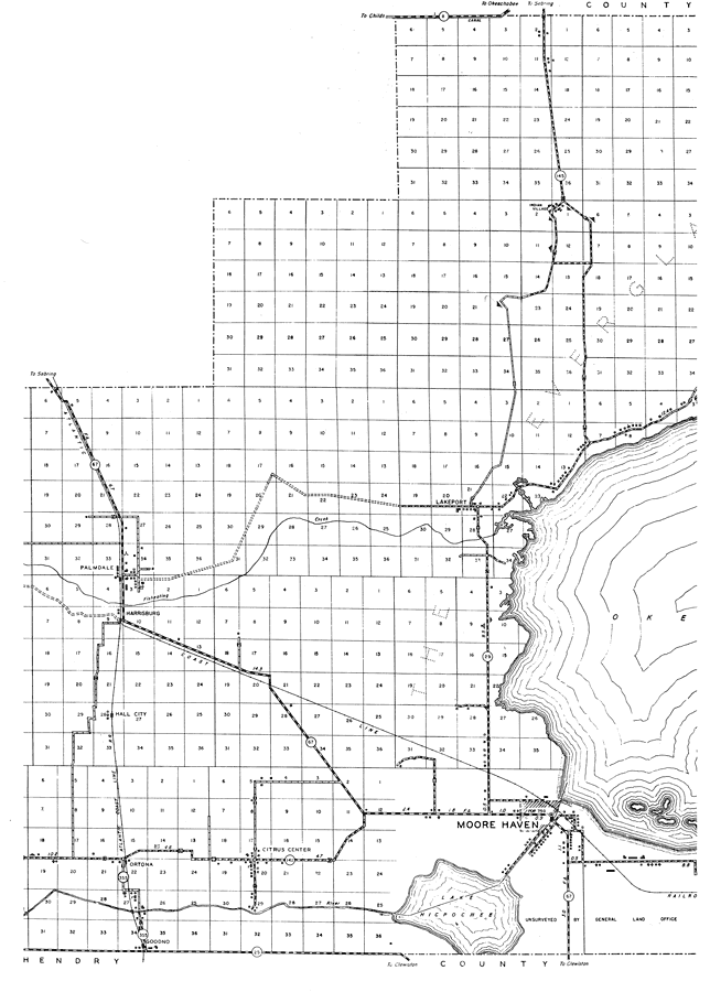
Description: This is a detailed map of the east side of the county of Glades in the state of Florida. Section Township Range (STR) is shown. This map shows all of the main cities, state roads, bridge highways, drawbridge highways, canals, railroads, emergency landing fields, inland waters, county boundary, camp or lodge, post offices, cattle guards, churches, farm units, dwellings other than farms, tenant houses, businesses, and schools. Key to Florida Highway maps.
Place Names: Glades, Indian Village, Lakeport, Everglades, Palmdale, Harrisburg, Lake Okeechobee, Fish Eating Creek, Hall City, Ortona, Citrus Center, Goodno, Moore Haven, Lake Hicpochee
ISO Topic Categories: inlandWaters, location, transportation, boundaries
Keywords: Mid Glades, physical, political, transportation, physical features, major political subdivisions, county borders, local jurisdictions, roads, railroads, water routes, inlandWaters, location, transportation, boundaries, Unknown,1936
Source: , Florida State Road Department (, FL: , 1936)
Map Credit: Courtesy the private collection of Roy Winkelman. |
|