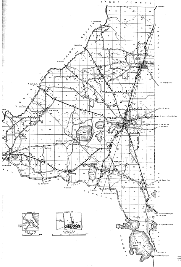
Description: This is a detailed map of the east side of the county of Bradford in the state of Florida. Section Township Range (STR) is shown. This map shows all of the main cities, state roads, US Highways, bridge highways, drawbridge highways, federal aided highways, saw mills, railroads, inland waters, canals, corporate lines, county boundaries, camps or lodges, post offices, emergency landing fields, forest ranger lookout stations, turpentine stills, cemeteries, churches, farm units, dwellings other than farms, tenant houses, businesses, townhalls, hotels, schools, hospitals and factories. Key to Florida Highway maps.
Place Names: Bradford, Starke, Lake Sampson, Crosby Lake, Little Santa Fe Lake, Hampton Beach, Hampton, Lawtey, Highland, Theressa, Lake Santa Fe, Graham, Sampson City, New River, Clayno, Santa Fe River
ISO Topic Categories: boundaries, location, transportation, inlandWaters
Keywords: East Bradford, physical, political, transportation, physical features, major political subdivisions, county borders, local jurisdictions, roads, railroads, boundaries, location, transportation, inlandWaters, Unknown,1936
Source: , Florida State Road Department (, FL: , 1936)
Map Credit: Courtesy the private collection of Roy Winkelman. |
|