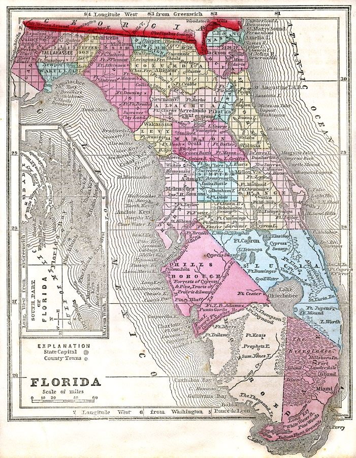
Description: A map of the state of Florida as of 1857 showing counties, the state capital, county seats, towns, forts, and bodies of water. Includes an inset map of the southern part of Florida.
Place Names: 1840-1859, Miami, Fort Myers, Fort Lauderdale, Tallahassee
ISO Topic Categories: boundaries, inlandWaters, oceans, biota
Keywords: Florida, physical, political, wetlands, everglades, swamps, physical features, major political subdivisions, county borders, boundaries, inlandWaters, oceans, biota, Unknown,1857
Source: Charles W. Morse, Diamond Atlas (New York, NY: Samuel Gaston , 1857)
Map Credit: Courtesy the private collection of Roy Winkelman |
|