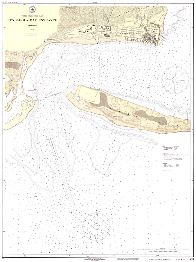
Description: A National Oceanic and Atmospheric Administration map of the entrance to the Pensacola Bay current to 1925. This Gulf Coast Survey chart shows all soundings expressed in feet. Navigational aids such as lights, beacons, buoys, and measures of magnetic declination variances are shown as well as obstructions such as submarine cable areas. The map scale is 1:10,000. Key to NOAA maps.
Place Names: Escambia, Pensacola, Fort Pickens, Santa Rosa Island, Warrington, Fort Barrancas
ISO Topic Categories: elevation, inlandWaters, oceans, transportation, utilitiesCommunication, boundaries
Keywords: Pensacola Bay Entrance, No. 413, physical, political, transportation, hydrological, physical features, topographical, local jurisdictions, water routes, water depths, elevation, inlandWaters, oceans, transportation, utilitiesCommunication, boundaries, Unknown,1925
Source: National Oceanic and Atmospheric Administration, Gulf Coast Survey (Washington, DC: United States Coast and Geodetic Survey, 1925)
Map Credit: Courtesy the U.S. National Oceanic and Atmospheric Administration |
|