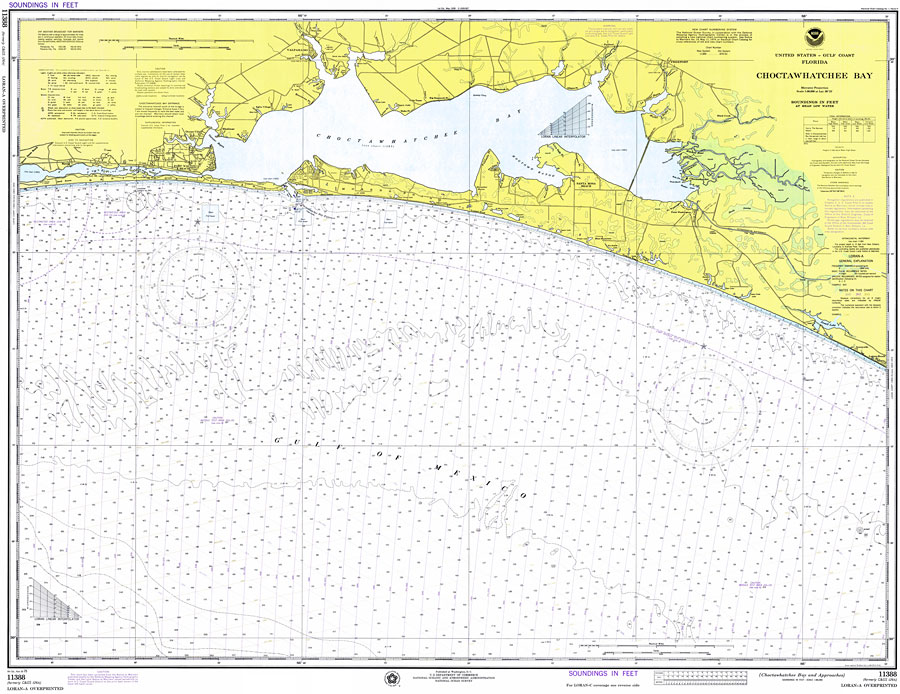
Title: Chocktawhatchee Bay
Projection: Mercator,
Source Bounding Coordinates:
W: -87 E: -85.5 N: 30.5 S: 30 |
| | Description: A National Oceanic and Atmospheric Administration map of the entrance to Chocktawhatchee Bay current to 1975. This National Ocean Survey chart shows all soundings expressed in feet. Navigational aids such as lights, beacons, buoys, and measures of magnetic declination variances are shown as well as obstructions such as fixed bridges and submerged wreckage. The map scale is 1:80,000. Chart is LORAN-A overprinted. N.O.A.A. map reference: 11388LORANA-11-1975. Key to NOAA maps. PLEASE NOTE: This historical data is not to be used for navigation or navigation planning. The Florida Center for Instructional Technology (FCIT) does not assume responsibility for the improper use of these data.
Source: National Oceanic and Atmospheric Administration, Coast Survey (Washington, DC: U. S. Department of Commerce, 1975)
Map Credit: Courtesy the U.S. National Oceanic and Atmospheric Administration |
| |
|