Title: Chassahowitzka River
Projection: Unknown
Source Bounding Coordinates:
W: E: N: S: |
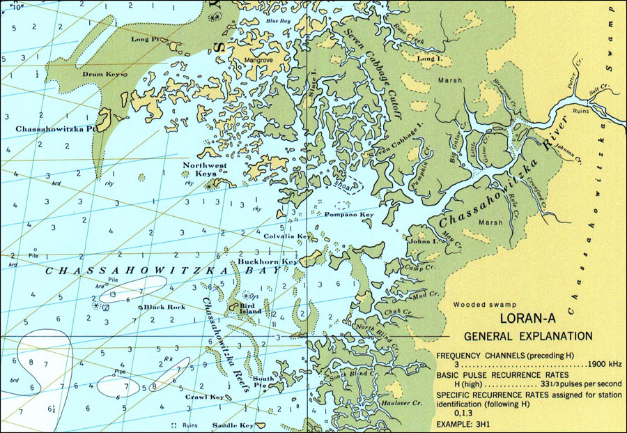
| | Description: A National Oceanic and Atmospheric Administration map of the Chassahowitzka Bay and entrance to the Chassahowitzka River current to 1977. This Survey chart shows all soundings expressed in feet. Hazards such as submerged ruins, pipes, and piles are also shown. Green lines included are TD (time difference) lines associated with the Loran-A navigation system. These do not extend to inland waterways as the Loran system works poorly over land. N.O.A.A. map reference: 11409-2-1977. Key to NOAA maps. PLEASE NOTE: This historical data is not to be used for navigation or navigation planning. The Florida Center for Instructional Technology (FCIT) does not assume responsibility for the improper use of these data.
Source: National Oceanic and Atmospheric Administration, (Washington, DC: United States Coast and Geodetic Survey, 1977)
Map Credit: Courtesy the U.S. National Oceanic and Atmospheric Administration |
| |
|