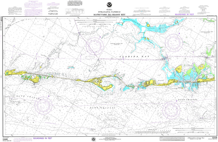
Description: A National Oceanic and Atmospheric Administration map north of the area between Matecumbe and Grassy Key current to1975. This Survey chart shows all soundings and heights expressed in feet. Navigational aids such as lights, beacons, buoys and measures of magnetic declination variances are shown as well as obstructions such as shoals, submerged piles, wreckage, fixed bridges, and overhead cables. The map scale is 1:40,000. N.O.A.A. map reference: 11449_A-8-1975. Key to NOAA maps. PLEASE NOTE: This historical data is not to be used for navigation or navigation planning. The Florida Center for Instructional Technology (FCIT) does not assume responsibility for the improper use of these data.
Place Names: Monroe, Lower Matecumbe Key, Long Key, Duck Key
ISO Topic Categories: transportation, inlandWaters, oceans
Keywords: Matecumbe to Grassy Key, physical, hydrological, transportation, physical features, water routes, water depths, transportation, inlandWaters, oceans, Mercator, 1975
Source: National Oceanic and Atmospheric Administration, National Ocean Survey (Washington, DC: National Oceanic and Atmospheric Administration, 1975)
Map Credit: Courtesy the U.S. National Oceanic and Atmospheric Administration |
|