Title: Matecumbe to Grassy Key
Projection: Mercator,
Source Bounding Coordinates:
W: E: N: S: |
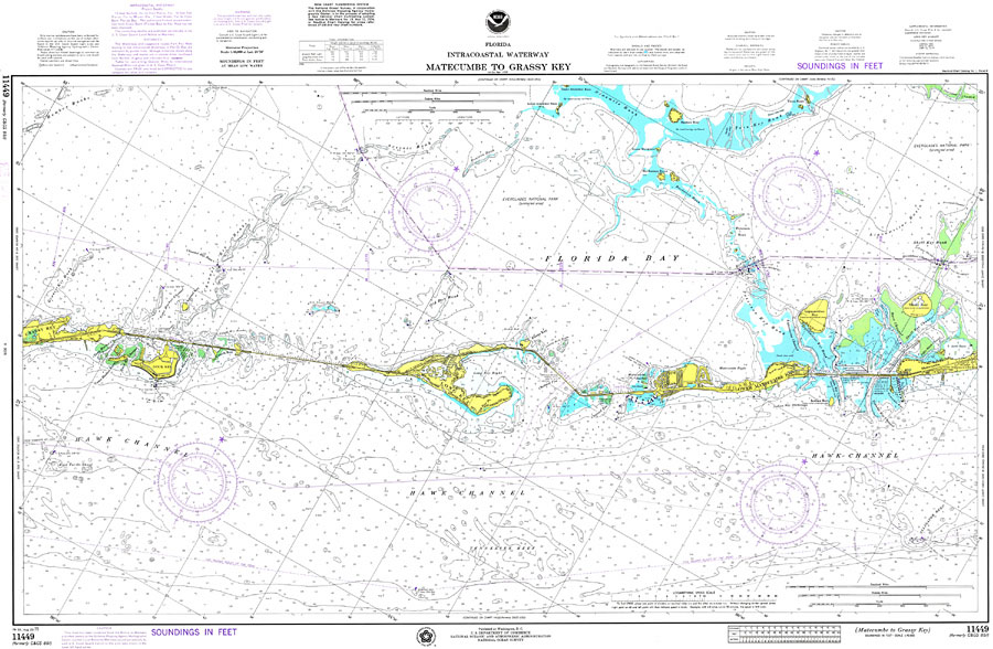
| | Description: A National Oceanic and Atmospheric Administration map north of the area between Matecumbe and Grassy Key current to1975. This Survey chart shows all soundings and heights expressed in feet. Navigational aids such as lights, beacons, buoys and measures of magnetic declination variances are shown as well as obstructions such as shoals, submerged piles, wreckage, fixed bridges, and overhead cables. The map scale is 1:40,000. Key to NOAA maps.
Source: National Oceanic and Atmospheric Administration, National Ocean Survey (Washington, DC: National Oceanic and Atmospheric Administration, 1975)
Map Credit: Courtesy the U.S. National Oceanic and Atmospheric Administration |
| |
|