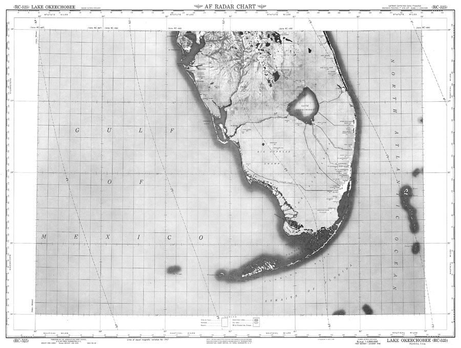
Description: An U.S. Air Force Aeronautical Chart Service map of Lake Okeechobee current to1948. This Radar chart shows Lake Okeechobee and surrounding cities and towns, including adjacent territory. The map scale is 1:1,000,000. Key to NOAA maps.
Place Names: 1920-1949, Lake Okeechobe
ISO Topic Categories: transportation, inlandWaters, oceans
Keywords: Lake Okeechobee, transportation, physical, physical features, air routes, transportation, inlandWaters, oceans, Lambert_Conformal_Conic, 1948
Source: U.S. Air Force, AF Radar Chart (Washington, DC: Aeronautical Chart Service, 1948)
Map Credit: Courtesy the U.S. National Oceanic and Atmospheric Administration |
|