Title: Anclote Keys to Crystal River
Projection: Mercator,
Source Bounding Coordinates:
W: -83.5 E: -82.5 N: 29 S: 28 |
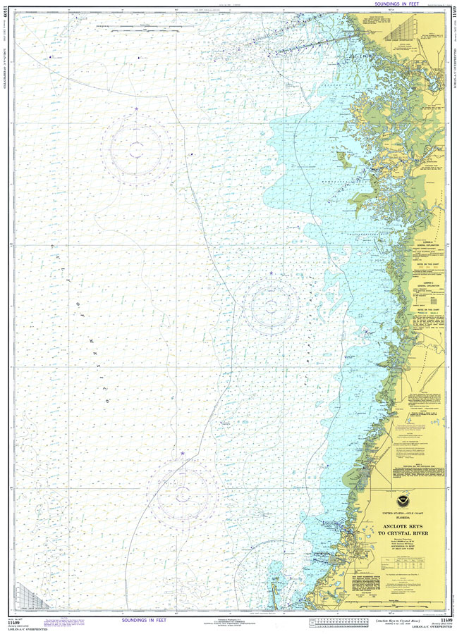
| | Description: A National Oceanic and Atmospheric Administration map of the Florida Gulf Coast from the Anclote Keys to Crystal River. This National Ocean Survey chart shows all soundings expressed in feet. Navigational aids such as safety fairways, and visual markers such as lights, buoys, and beacons are shown as well as obstructions such as submerged ruins and piles. Scale 1:80,000. North American 1927 Datum used. Map is LORAN-A overprinted. Key to NOAA maps.
Source: National Oceanic and Atmospheric Administration, National Ocean Survey (Washington, DC: Natonal Oceanic and Atmospheric Administraton, 1977)
Map Credit: Courtesy of the U.S. National Oceanic and Atmospheric Administration |
| |
|