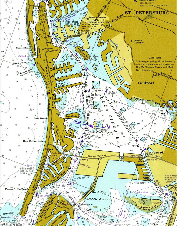
Description: A National Oceanic and Atmospheric Administration map of the Intracoastal Waterway and entrance to Boca Ciega Bay near St. Petersburg. This National Ocean Survey chart shows all soundings expressed in feet. Navigational aids such as safety fairways and visual markers such as lights, buoys and beacons are shown as well as obstructions such as fixed bridges, submerged piles and cables. Key to NOAA maps.
Place Names: Pinellas, St. Petersburg
ISO Topic Categories: transportation, oceans, inlandWaters
Keywords: St. Petersburg, physical, transportation, hydrological, physical features, roads, water routes, water depths, transportation, oceans, inlandWaters, Mercator, 1977
Source: National Oceanic and Atmospheric Administration, National Ocean Survey (Washington, DC: National Oceanic and Atmospheric Administration, 1977)
Map Credit: Courtesy of the U.S. National Oceanic and Atmospheric Administration |
|