Title: Tampa Bay, Southern Part
Projection: Mercator,
Source Bounding Coordinates:
W: -83 E: -82.5 N: 28 S: 27.5 |
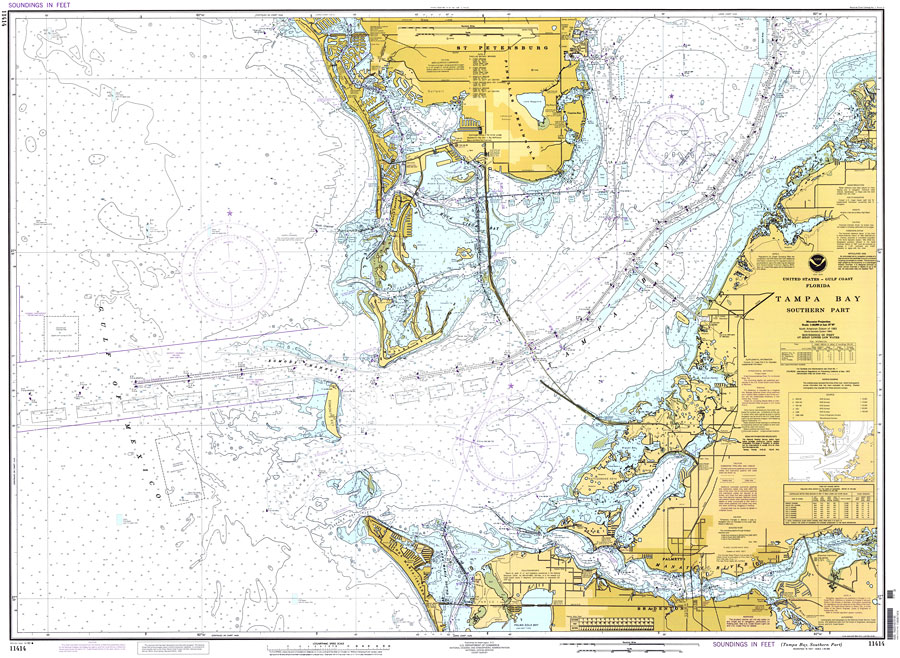
| | Description: A National Oceanic and Atmospheric Administration map of the southern end of Tampa Bay and its entrance, 1996. This Ocean Survey chart shows all soundings expressed in feet. Navigational aids such as safety fairways, and visual markers such as lights, buoys, and beacons are shown as well as obstructions such as fixed bridges, submerged ruins, pipes, cables, and piles. Measure of magnetic variance and annual change included. Scale 1:40,000. North American Datum 1983 and World Geodetic System 1984 are used. Key to NOAA maps.
Source: National Oceanic and Atmospheric Administration, Coast Survey (Washington, DC: U.S. Department of Commerce, 1996)
Map Credit: Courtesy of the U.S. National Oceanic and Atmospheric Administration |
| |
|