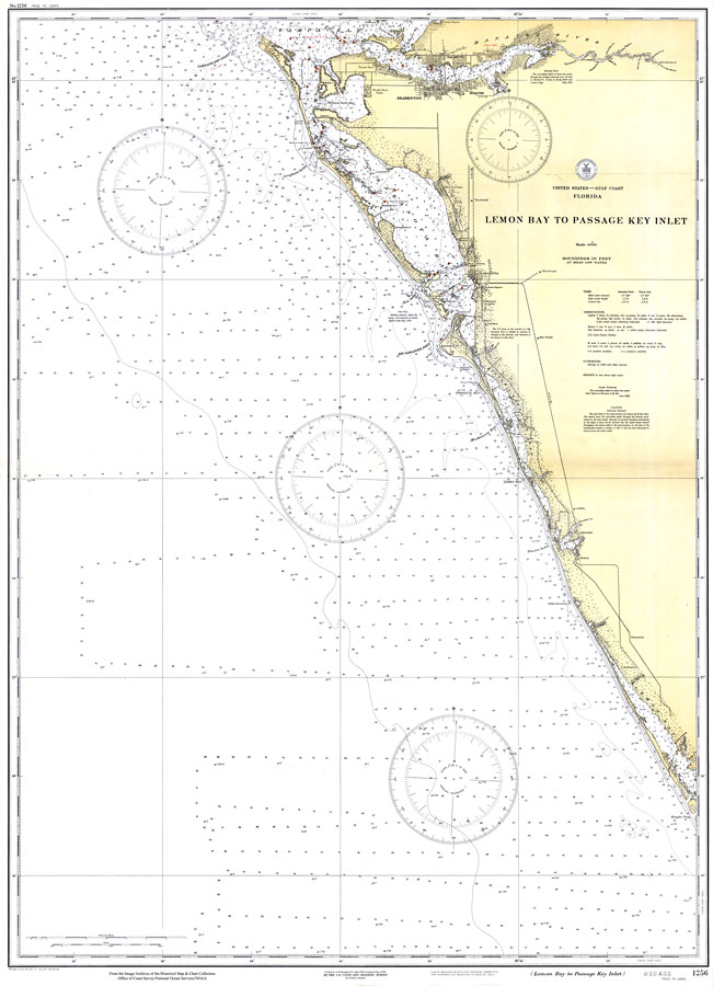
Description: A US Coast and Geodetic Survey map of the Gulf Coast of Florida from Lemon Bay to the Passage Key Inlet near Bradenton. This survey chart shows all soundings expressed in feet. Navigational aids such as safety fairways, and visual markers such as lights, buoys, and beacons are shown as well as obstructions. Measure of magnetic variance and annual change included. Scale 1:80,000. Key to NOAA maps.
Source: US Coast and Geodetic Survey, (Washington, DC: US Coast and Geodetic Survey, 1934)
Map Credit: Courtesy of the U.S. National Oceanic and Atmospheric Administration |
|