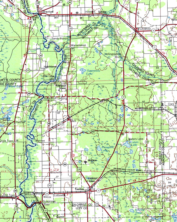
Description: A National Oceanic and Atmospheric Administration map of Gilchrist County current to1975. This map shows Gilchrist county and its jurisdicitions along with surrounding counties. Navigational aids such as lights, beacons, buoys and measures of magnetic declination variances are shown as well as obstructions such as shoals, submerged piles, wreckage, fixed bridges, and overhead cables. The map scale is 1:250,000. North Geodetic Vertical Datum1929 is used. NOAA Map Reference: NH17-7 Key to NOAA maps. PLEASE NOTE: This historical data is not to be used for navigation or navigation planning. The Florida Center for Instructional Technology (FCIT) does not assume responsibility for the improper use of these data.
Place Names: Gilchrist, Bell, Blue Springs, Craggs, Ginnie Springs, Hart Springs, Little Lake City, Lottieville, Neals, Otter Spring, Rock Bluff Springs, Santa Fe River, Suwannee River, Trenton, Tyler, Wanamake, Wannee, Waters Lake, Wilcox, Williford
ISO Topic Categories: boundaries, transportation, inlandWaters
Keywords: Gilchrist County, physical, political, transportation, physical features, county borders, local jurisdictions, major political subdivisions, water routes, railroads, roads, boundaries, transportation, inlandWaters, Transverse_Mercator, 1975
Source: U.S. Geologic Survey and National Ocean Service, Eastern United States (Reston, VA: NOAA, 1975)
Map Credit: Courtesy the U.S. National Oceanic and Atmospheric Administration |
|