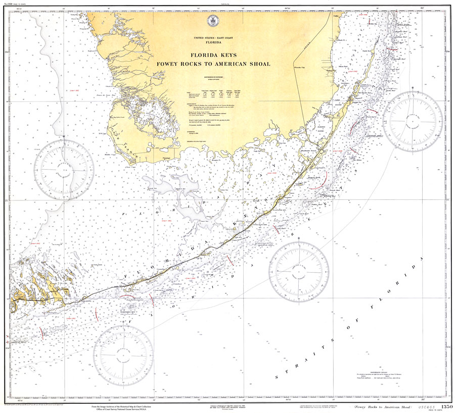
Description: A National Oceanic and Atmospheric Administration map of South Florida and the Florida Keys, 1929. This Gulf Coast Survey chart shows all soundings expressed in fathoms. Navigational aids such as lights, beacons, buoys, and measures of magnetic declination variances are shown as well as obstructions such as submerged wrecks and rocks. Key to NOAA maps.
Place Names: 1920-1949, Key Largo, Turkey Point, Cutler, Islamorada, Marathon, Flamingo,
ISO Topic Categories: transportation, oceans
Keywords: Florida Keys: Fowey Rocks to American Shoal, physical, transportation, hydrological, physical features, roads, railroads, water depths, transportation, oceans, Unknown,1929
Source: US Department of Commerce, (Washington, DC: US Coast and Geodetic Survey, 1929)
Map Credit: Courtesy the U.S. National Oceanic and Atmospheric Administration |
|