mapsExploring Florida
 FL Maps > Region > 1920-1949 > Florida Keys: Fowey Rocks to American Shoal, 1929
Site Map 

Florida Keys: Fowey Rocks to American Shoal, 1929


Puzzle Directions: Click on a puzzle piece and drag it where you want it. When you connect two pieces correctly, they will join together. Mix up the pieces again. View finished map in pop-up window.

Title: Florida Keys: Fowey Rocks to American Shoal
Projection: Unknown
Source Bounding Coordinates:
W: -81.5 E: -80 N: 25.5 S: 24.5

Back to Map Page
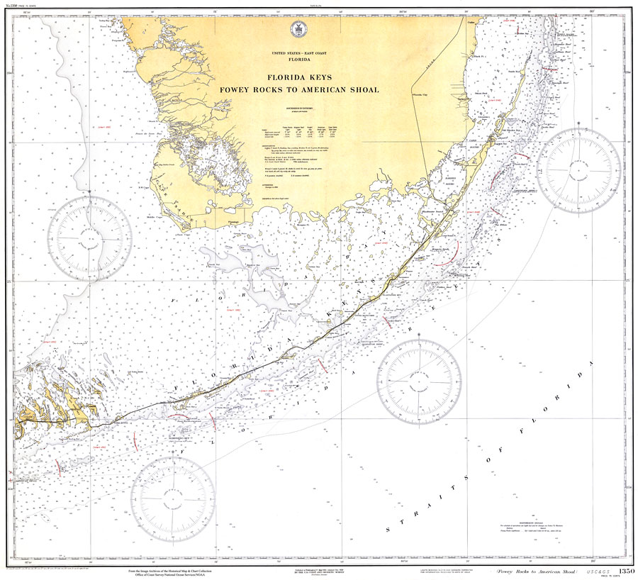
Description: A National Oceanic and Atmospheric Administration map of South Florida and the Florida Keys, 1929. This Gulf Coast Survey chart shows all soundings expressed in fathoms. Navigational aids such as lights, beacons, buoys, and measures of magnetic declination variances are shown as well as obstructions such as submerged wrecks and rocks. Key to NOAA maps.
Source: US Department of Commerce, (Washington, DC: US Coast and Geodetic Survey, 1929)
Map Credit: Courtesy the U.S. National Oceanic and Atmospheric Administration
SearchLicensePDF HelpGIS Help Google Earth Help Zoomify Help

 FL Maps > Region > 1920-1949 > Florida Keys: Fowey Rocks to American Shoal, 1929