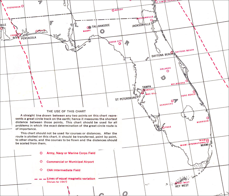
Description: US Coast and Geodetic Survey chart of Florida showing great circle outlines. Since the eye of the constructor is assumed to be at the center of the terrestrial globe, every great circle appears projected on the chart as a straight line. The meridians, being parts of great circles, appear on the chart as straight lines and the parallels as conic sections. Map also includes military air fields, commercial and municipal airports, CAA intermediate fields, and lines of equal magnetic variation. Key to NOAA maps.
Place Names: 1920-1949, Daytona Beach, Jacksonville, Key West, Miami, Orlando, Tallahassee, Tampa, Pensacola, St Petersburg
ISO Topic Categories: oceans, inlandWaters, boundaries
Keywords: Great Circle Outline Chart of Florida, physical, political, magnetic variance, physical features, major political subdivisions, oceans, inlandWaters, boundaries, Gnomonic, 1941
Source: US Coast and Geodetic Survey, Great Circle Outline Charts: Aeronautical Edition (Washington, DC: US Coast and Geodetic Survey, 1941)
Map Credit: Courtesy the U.S. National Oceanic and Atmospheric Administration |
|