mapsExploring Florida
 FL Maps > Region > 1920-1949 > Inland Water Route from St. Augustine to Titusville, 1928
Site Map 

Inland Water Route from St. Augustine to Titusville, 1928


Puzzle Directions: Click on a puzzle piece and drag it where you want it. When you connect two pieces correctly, they will join together. Mix up the pieces again. View finished map in pop-up window.

Title: Inland Water Route from St. Augustine to Titusville
Projection: Unknown
Source Bounding Coordinates:
W: -81 E: -80.5 N: 30 S: 28.5

Back to Map Page
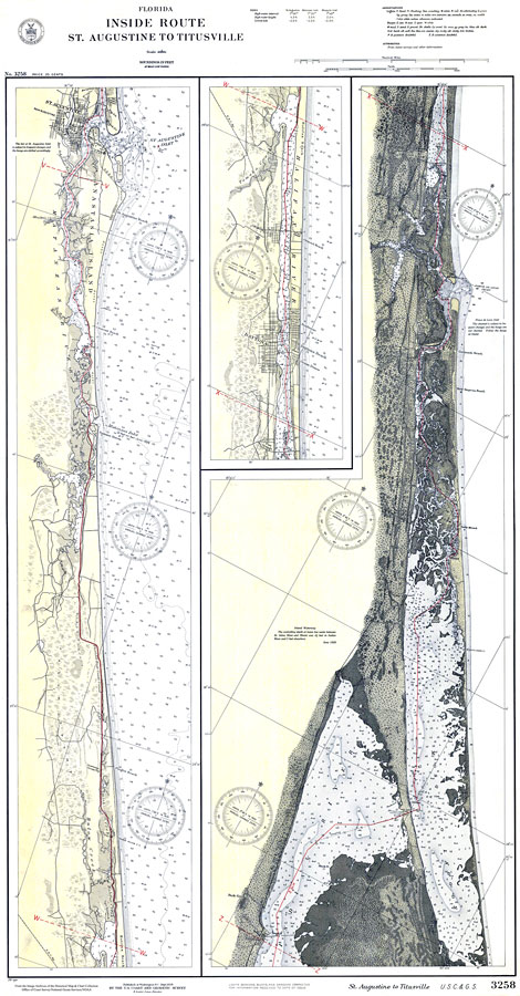
Description: A US Coast and Geodetic Survey map of the inland waterway between St. Augustine and Titusville. This survey chart shows all soundings expressed in feet. Navigational aids such as lights, beacons, buoys, and measures of magnetic declination variances are shown as well as obstructions such as bridges and submerged wrecks. The map scale is 1:80,000. Key to NOAA maps.
Source: US Coast and Geodetic Survey, (Washington, DC: US Coast and Geodetic Survey, 1928)
Map Credit: Courtesy the U.S. National Oceanic and Atmospheric Administration
SearchLicensePDF HelpGIS Help Google Earth Help Zoomify Help

 FL Maps > Region > 1920-1949 > Inland Water Route from St. Augustine to Titusville, 1928