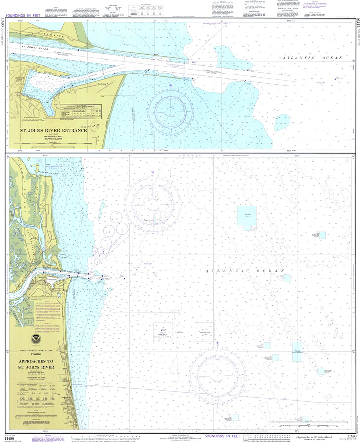
Title: Approaches to St. Johns River
Projection: Mercator,
Source Bounding Coordinates:
W: -81.5 E: -81 N: 30.5 S: 30 |
| | Description: A National Oceanic and Atmospheric Administration map of the approaches and entrance to the St. Johns River, current to 1978. This National Ocean Survey chart shows all soundings expressed in feet. Navigational aids such as lights, beacons, buoys and measures of magnetic declination variances are shown as well as obstructions such as fishing havens, submerged rocks, and piles. Restricted areas and danger areas due to mines on the bottom are also included. North American 1927 Datum used. The map scale is 1:40,000. Key to NOAA maps.
Source: National Oceanic and Atmospheric Administraton, National Ocean Survey (Washington, DC: National Oceanic and Atmospheric Administration, 1978)
Map Credit: Courtesy the U.S. National Oceanic and Atmospheric Administration |
| |
|