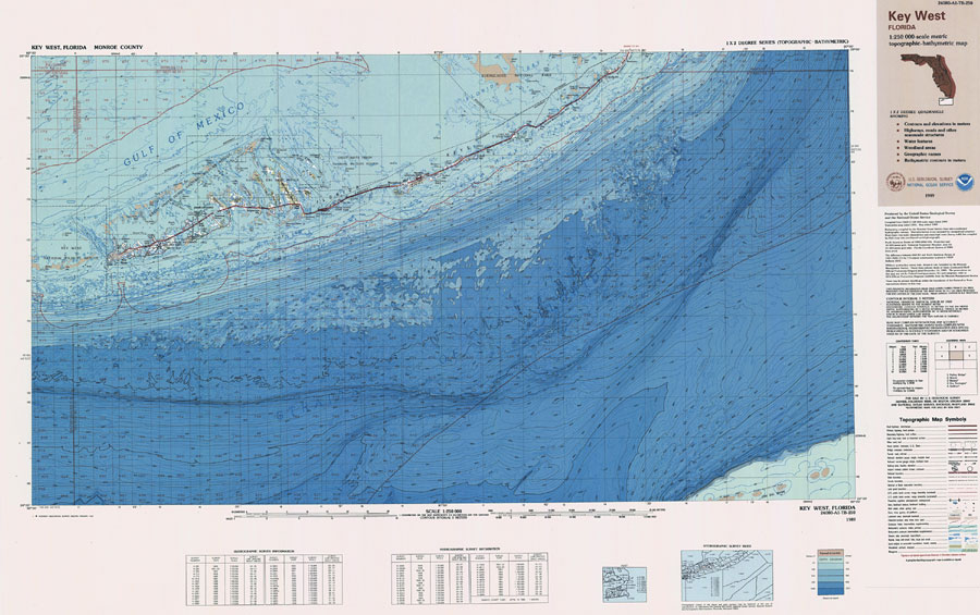
Description: A US Geological Survey and National Ocean Service map of the Florida Keys current to 1989. This topographic-bathymetric map shows elevations and depths in meters. Bathymetric contour interval 10 meters. 1989 magnetic declination from true north varies from 2 degrees westerly for the west edge of the map to 3 1/2 degrees westerly for the east edge. Mean annual change is 8.6' westerly. Map also includes roads, waterways, airports, and national parks and refuges. North American 1983 Datum used. The map scale is 1:250,000, metric . Key to NOAA maps.
Source: US Geological Survey and National Ocean Service, (Colorado Springs, CO: US Geological Survey, 1989)
Map Credit: Courtesy the U.S. National Oceanic and Atmospheric Administration |
|