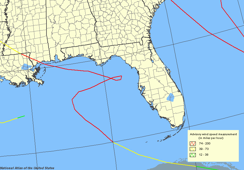
Description: This map shows the routes of major hurricanes that made landfall in the United States classified on the Saffir-Simpson Hurricane Scale as category 3 or higher hurricanes in 1980's.
Place Names: Storms by Decade, Gulf of Mexico, �Atlantic Ocean
ISO Topic Categories: climatologyMeteorologyAtmosphere, �boundaries, �oceans
Keywords: Hurricane Routes, political, �meteorological, �khurricane, country borders, �county borders, winds, climatologyMeteorologyAtmosphere, �boundaries, �oceans, Unknown,1980-1989
Source: National Hurricane Center, National Atlas (, : U. S. Geological Survey, )
Map Credit: Courtesy of the National Atlas. |
|