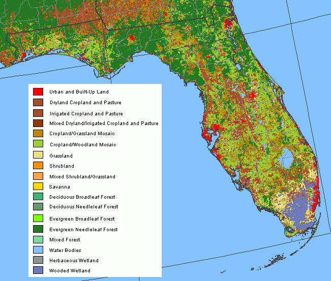
Description: This data set is an Arc/INFO grid map of land cover characteristics for Florida. The information was compiled by staff at the Earth Resources Observation and Science Data Center as part of the Global Land Cover Characterization Project. The land cover classes were produced using 1-km AVHRR data from April 1992 to March 1993.
Place Names: 1950-1999,
ISO Topic Categories: boundaries, biota, environment
Keywords: Land Cover Characteristics, political, Land Cover, Land Use, Urban and Built-Up Land, Dryland Cropland and Pasture, Irrigated Cropland and Pasture, Mixed Dryland/Irrigated Cropland and Pasture, Cropland/Grassland Mosaic, Grassland, Shrubland, Mixed Shrubland/Grassland, Savanna, Deciduous Broadleaf Forest, Deciduous Needleleaf Forest, Evergreen Broadleaf Forest, Evergreen Needleleaf Forest, Mixed Forest, Water Bodies, Herbaceous Wetland, Wooded Wetland, county borders, boundaries, biota, environment, Unknown,1992-1993
Source: Earth Resources Observation and Science, National Atlas (U. S. Geological Survey, )
Map Credit: Courtesy of the National Atlas. |
|