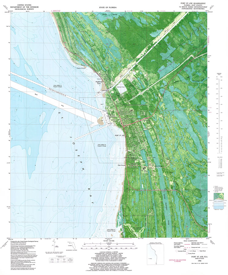
Description: A US Geological Survey and National Ocean Service map of Port St. Joe current to 1982. The map shows both topographic and bathymetric features. Topographic contour lines are shown at 2-meter intervals with supplemental contour intervals at 1 meter. Bathymetric contour intervals are at 1 meter with supplementary 0.5-meter contours. Bathymetric datum is mean lower low water. The map shows man made structures such as primary and secondary roads, radio towers, canals, bridges, hospitals, residences, schools et cetera. Navigational aids include lights and buoys. Natural features include swamps, drylands, wetlands and partially submerged land exposed at mean low tide. Map is divided into townships and ranges based on the Tallahassee baseline and meridian. The map scale is 1:24,000. This information is not intended for navigational purposes. The National Geodetic Vertical Datum of 1929 is used. The projection used 1927 North American Datum with reference on converting to North American Datum 1983. NOAA Map Reference: 29085_G3_TB_024-00-1982. Key to NOAA maps. PLEASE NOTE: This historical data is not to be used for navigation or navigation planning. The Florida Center for Instructional Technology (FCIT) does not assume responsibility for the improper use of these data.
Place Names: Gulf, Port St. Joe, Highland View, Palm Point,
ISO Topic Categories: inlandWaters, oceans, transportation
Keywords: Port St. Joe, physical, transportation, hydrological, physical features, topographical, roads, water depths, inlandWaters, oceans, transportation, Lambert_Conformal_Conic, Transverse_Mercator, 1982
Source: USGS and NOAA, Port St. Joe Quadrangle (Reston, VA: United States Geological Survey, 1982)
Map Credit: Courtesy the U.S. National Oceanic and Atmospheric Administration |
|