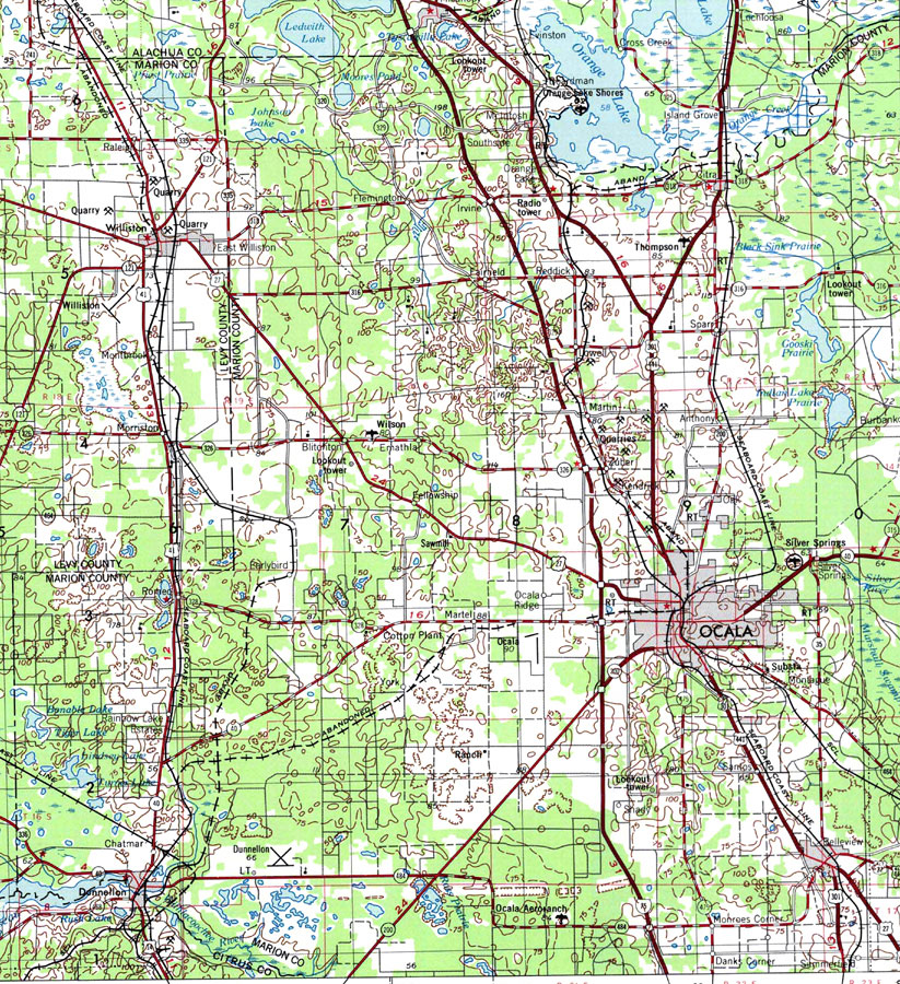
Description: A portion of Gainesville Geological Survey and National Ocean Service map showing the Ocala area current to 1978. The map shows State, primary and secondary roads, railroad lines and airports. Natural features include lakes, rivers and swamps. The map scale is 1:250,000. Key to USGS maps
Place Names: Marion, Ocala, Dunnellon, Belleview
ISO Topic Categories: inlandWaters, transportation
Keywords: Ocala, physical, transportation, physical features, topographical, roads, railroads, inlandWaters, transportation, Transverse_Mercator, 1978
Source: USGS and NOAA, Gainesville, Florida (Reston, VA: United States Geological Survey, 1978)
Map Credit: Courtesy the U.S. National Oceanic and Atmospheric Administration |
|