Title: Pensacola
Projection: Transverse_Mercator,
Source Bounding Coordinates:
W: -88 E: -87 N: 30.5 S: 30 |
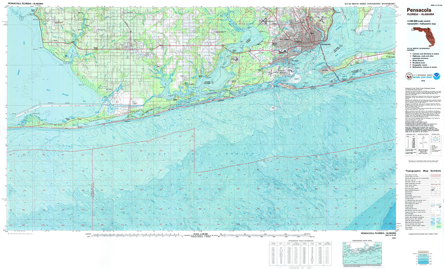
| | Description: A US Geological Survey and National Ocean Service map of the Pensacola Bay area including portions of Baldwin County, Alabama, current to 1978. . The map shows both topographic and bathymetric features. Topographic contour lines are shown at 5-meter intervals. Bathymetric contour intervals are at 2 meters with supplementary 1-meter contours. Bathymetric datum is mean lower low water. The map shows man made structures such as primary and secondary roads, bridges, airports, Intracoastal Waterway, parks and built up areas. Natural features include lakes, rivers and swamps. Map is divided into townships and ranges based on the Tallahassee baseline and meridian. The map scale is 1:100,000. This information is not intended for navigational purposes. The National Geodetic Vertical Datum of 1929 is used. The projection used 1927 North American Datum with reference on converting to North American Datum 1983. Key to USGS maps.
Source: USGS and NOAA, Pensacola Quadrangle (Reston, VA: United States Geological Survey, 1978)
Map Credit: Courtesy the U.S. National Oceanic and Atmospheric Administration |
| |
|