mapsExploring Florida
 FL Maps > Region > 1760-1779 > Plan of the Town of St. Augustine the capital of East Florida / The Bay of Espiritu Santo on the Western Coast of East Florida, 1777
Site Map 

Plan of the Town of St. Augustine the capital of East Florida / The Bay of Espiritu Santo on the Western Coast of East Florida, 1777


Puzzle Directions: Click on a puzzle piece and drag it where you want it. When you connect two pieces correctly, they will join together. Mix up the pieces again. View finished map in pop-up window.

Title: Plan of the Town of St. Augustine the capital of East Florida / The Bay of Espiritu Santo on the Western Coast of East Florida
Projection: Unknown
Source Bounding Coordinates:
W: E: N: S:

Back to Map Page
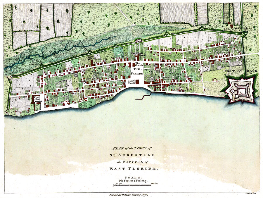
Description: Digitization provided by the USF Libraries Digitization Center. Rare Maps. This is a map of both the plan of Saint Augustine and the Bay of Espiritu Santo area. Oriented with north to the right. Relief shown pictorially. Streets and primary buildings of St. Augustine are shown. Depths of bay shown in British feet for the Bay of Espriritu Santo. Distances in British miles. Measurements.Resolution: Scale [ca. 1:4,800]. "660 feet or 1 furlong." (This scale is for the map of Saint Augustine.)
Source: Thomas D. Jefferys, The North American atlas, selected from the most authentic maps, charts, plans, &c. hitherto published. (London, : William Faden, 1777)
Map Credit: Courtesy of the Special Collections Department, University of South Florida.
SearchLicensePDF HelpGIS Help Google Earth Help Zoomify Help

 FL Maps > Region > 1760-1779 > Plan of the Town of St. Augustine the capital of East Florida / The Bay of Espiritu Santo on the Western Coast of East Florida, 1777