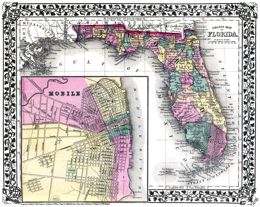
Description: Digitization provided by the USF Libraries Digitization Center. Rare Maps. This is a detailed, hand colored county map of Florida showing counties, cities, inland waters, railroads, etc. There is an inset map of Mobile, Alabama. Map states, "Entered according to act of Congress in the year 1876 by S. Augustus Mitchell..." Prime meridians: Greenwich and Washington. Measurements.Dimensions: 27.5 x 35 cm. Measurements.Resolution: Scale [ca. 1:3,484,800]
Place Names: 1860-1879, Atlantic Ocean, Jacksonville, Pensacola, Apalachicola, Tallahassee, Saint Augustine, Gainesville, Tampa, Cape Canaveral, Fernandina, Sarasota, Miami, Fort Myers, Lake Okeechobee, Fort Lauderdale, Gulf of Mexico, Key West
ISO Topic Categories: inlandWaters, oceans, boundaries, transportation
Keywords: County Map of Florida, physical, historical, political, transportation, country borders, county borders, railroads, inlandWaters, oceans, boundaries, transportation, Unknown,1876
Source: S. Augustus Mitchell, (, PA: S. Augustus Mitchell, 1876)
Map Credit: Courtesy of the Special Collections Department, University of South Florida. |
|