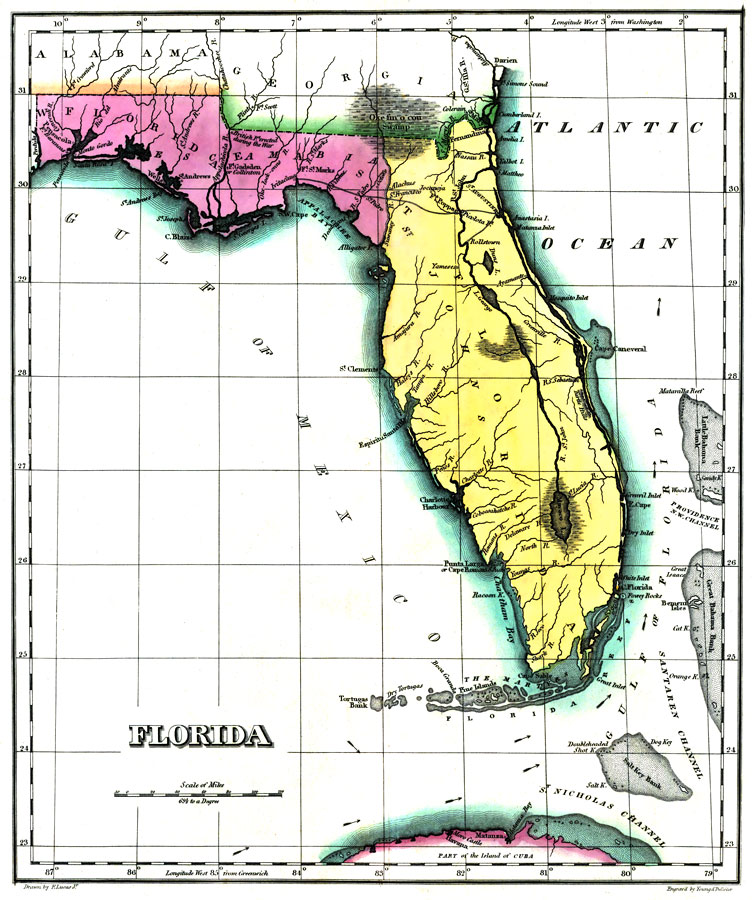
Title: Geographical, Statistical, and Historical Map of Florida No. 37
Projection: Unknown
Source Bounding Coordinates:
W: E: N: 32 S: 23 |
| | Description: Digitization provided by the USF Libraries Digitization Center. Rare Maps. This is a map of Florida in full color by region surrounded by text. Modeled on Le Sage's plan of having explanatory text surrounding the maps. 1st Edition; Fielding Lucas engraved most of the maps. The 1823 edition was unchanged in most copies, a few have minor map updates, and one has all of the 1827 edition maps while still retaining the 1823 title page and most of the text. The 1827 edition includes much new material, with all the maps and text updated, except for the Washington, D. C. and Michigan maps. Engraved by Young & Delleker. Measurements.Dimensions: 28 x 23 cm., on sheet 45 x 56 cm Measurements.Resolution: Scale [ca. 1:3,738,240]
Source: Henry Charles Carey, Isaac Lea and Fielding Lucas, A Complete Historical, Chronological, And Geographical American Atlas, Being A Guide To The History Of North And South America, And The West Indies ... To The Year 1822. According To The Plan Of Le Sage's Atlas And Intended As A Companion To Lavoisne's Improvement Of That Celebrated Work. (Philadelphia, PA: Carey and Lea, 1822)
Map Credit: Courtesy of the Special Collections Department, University of South Florida. |
| |
|