Title: Orange Grove Plats, 5 Acres Each. East Half Section 1, Township 7, Range 24 East.
Projection: Unknown
Source Bounding Coordinates:
W: E: N: S: |
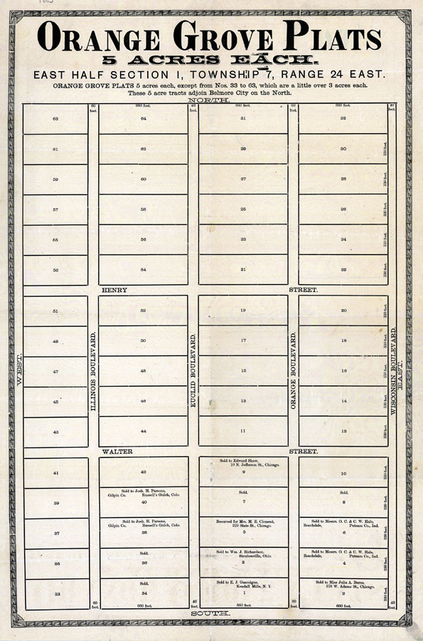
| | Description: Digitization provided by the USF Libraries Digitization Center. Rare Maps. This is a map of orange grove plats in Belmore, Florida. It shows streets, owners names, etc. Orange Grove Plats 5 acres each, except numbers 33 to 63 which are a little over 3 acres each. These 5 acre tracts adjoin Belmore City on the North.
Source: J. J. Trevers, Revised plat of the city of Belmore, Fla. (Belmore, FL: Belmore Florida Land Co., 1885)
Map Credit: Courtesy of the Special Collections Department, University of South Florida. |
| |
| FL Maps > Local > Clay > Orange Grove Plats, 5 Acres Each. East Half Section 1, Township 7, Range 24 East., 1885 AD | |
|