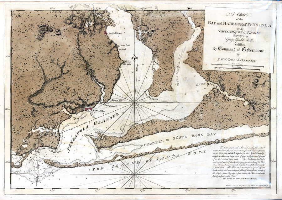
Description: Digitization provided by the USF Libraries Digitization Center. Rare Maps. This is a map showing the chart of the bay and harbor of Pensacola, circa 1780. This map shows physical features, cities and towns, inland waters and water depths. The statement "This harbor and all the coast abound with worms" is a warning of ship worms to others travelling there. Measurements.Dimensions: 52 x 75 cm. Measurements.Resolution: Scale [ca. 1:64,000]
Place Names: Escambia, Pensacola, Campbell Town, Pensacola Bay, Santa Rosa Island
ISO Topic Categories: boundaries, environment, inlandWaters
Keywords: A Chart of the Bay and Harbour of Pensacola, hydrological, physical, historical, physical features, water depths, boundaries, environment, inlandWaters, Unknown,1780
Source: Joseph F. W. Des Barres, (London, : Joseph F. W. Des Barres, 1780)
Map Credit: Courtesy of the Special Collections Department, University of South Florida. |
|