Title: Ybor City area of Tampa, Florida
Projection: Unknown
Source Bounding Coordinates:
W: E: N: S: |
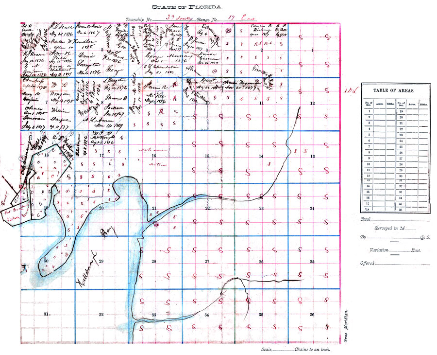
| | Description: Digitization provided by the USF Libraries Digitization Center. Rare Maps. This is the plat of Ybor City area, circa 1886. It shows names of land owners, inland waters, cities and towns. Section Township Range (STR) is shown. Note on map states that it came from the "personal life of Gavino Guitierrez." Measurements.Dimensions: 43 x 35.5 cm.
Source: Gavino Guitierrez, (Ybor City, FL: Gavino Guitierrez, 1886)
Map Credit: Courtesy of the Special Collections Department, University of South Florida. |
| |
|