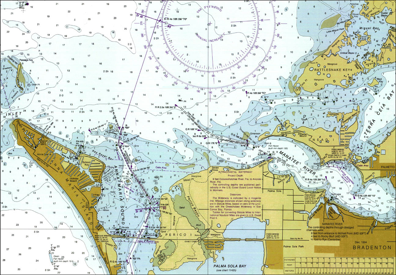
Description: A National Oceanic and Atmospheric Administration map of Mouth of Manatee River current to 2000. This Department of Commerce chart shows all soundings expressed in feet at mean lower low water. Navigational aids such as lights, beacons and buoys are shown as well as obstructions such as shoals, submerged piles, wreckages, fixed bridges and overhead cables. The map scale is 1:40,000. North American Datum of 1983 and World Geodetic System of 1984 are used. Key to NOAA maps.
Place Names: Manatee, Bradenton, Manatee, Anna Maria, Rattlesnake Key, Sneadi,
ISO Topic Categories: inlandWaters, oceans, transportation
Keywords: Mouth of the Manatee River, physical, transportation, hydrological, physical features, roads, water routes, water depths, inlandWaters, oceans, transportation, Mercator, 2000
Source: National Oceanic and Atmospheric Administration, Tampa Bay Entrance (Washington, DC: U.S. Department of Commerce, 2000)
Map Credit: Courtesy the U.S. National Oceanic and Atmospheric Administration |
|