mapsExploring Florida
 FL Maps > County > St. Johns > St. Johns County, 1886
Site Map 

St. Johns County, 1886


Puzzle Directions: Click on a puzzle piece and drag it where you want it. When you connect two pieces correctly, they will join together. Mix up the pieces again. View finished map in pop-up window.

Title: St. Johns County
Projection: Unknown
Source Bounding Coordinates:
W: E: N: S:

Back to Map Page
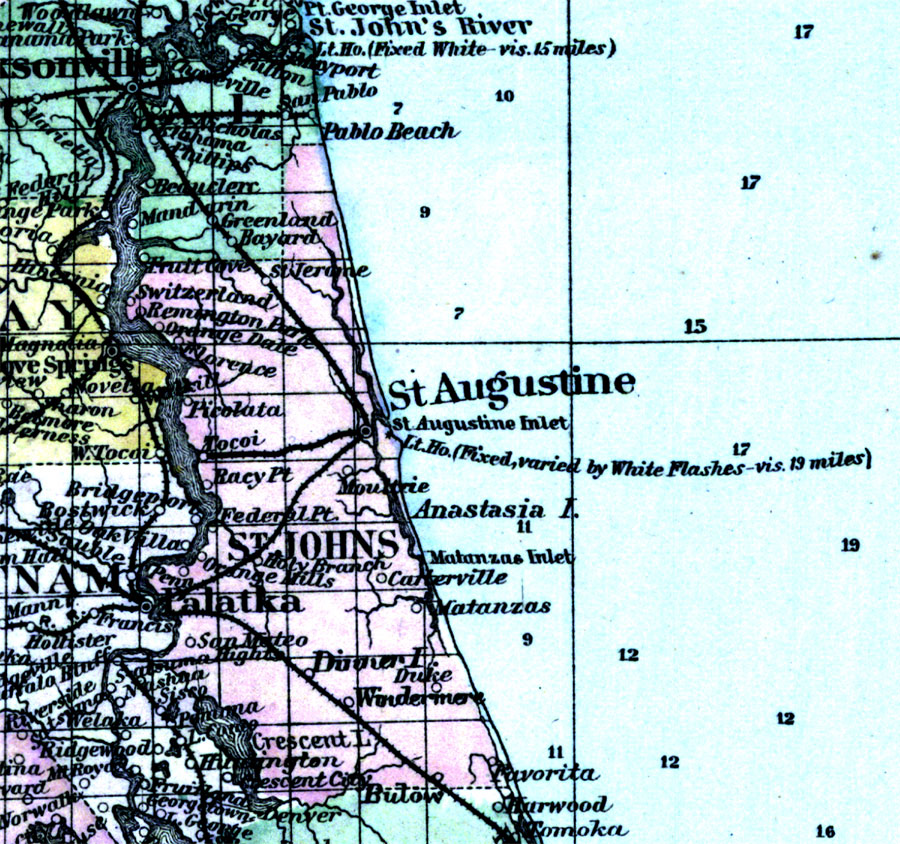
Description: This is a detailed map of Saint Johns County, Florida showing the County Seat, major cities, roads, railroads, inland waters, etc. Township and range grid established from the Tallahassee baseline and meridian shows the extent of land survey in the county in 1886. Map scale is 1:1,800,000.
Source: Ormando Willis Gray, Gray's Atlas (Phiadelphia, PA: O. W. Gray and Son, 1886) 91
Map Credit: Courtesy of the Special Collections Department, University of South Florida.
SearchLicensePDF HelpGIS Help Google Earth Help Zoomify Help

 FL Maps > County > St. Johns > St. Johns County, 1886