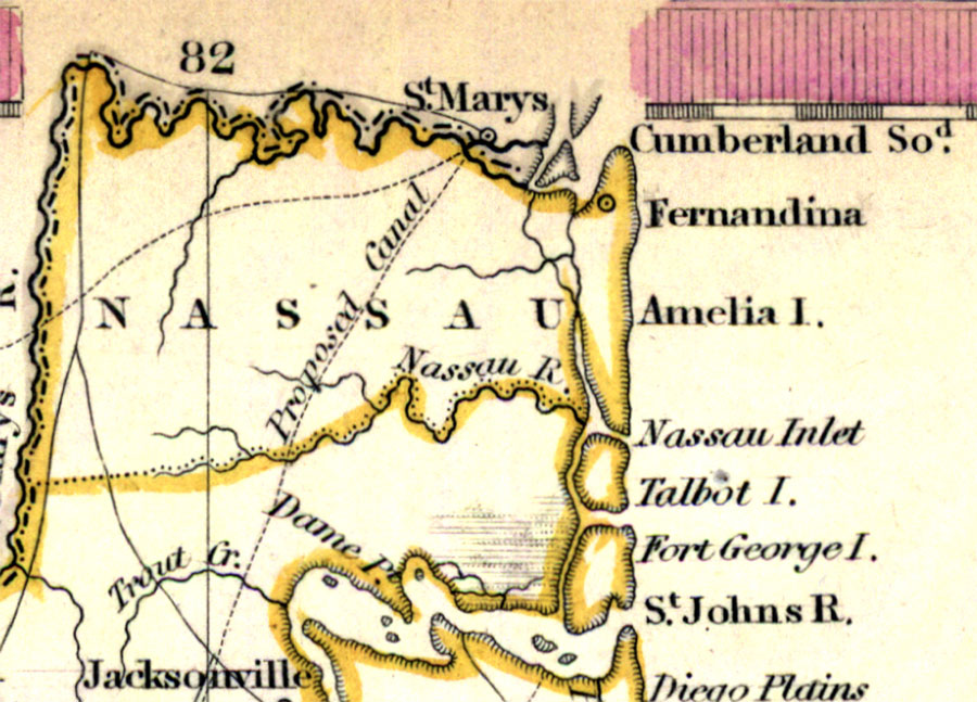
Description: Digitization provided by the USF Libraries Digitization Center. Rare Maps. This is a detail of Nassau County from a hand colored map of Florida, circa 1834. Nassau County is shown in its present day location. This map shows cities and towns, inland waters and county borders. There are inland waters such as the Nassau River and St. Marys River. Scale [ca. 1:1,774,080].
Source: Henry Schenck Tanner, North America XIV, Florida (London, : Baldwin & Cradock, 1834)
Map Credit: Courtesy of the Special Collections Department, University of South Florida. |
|