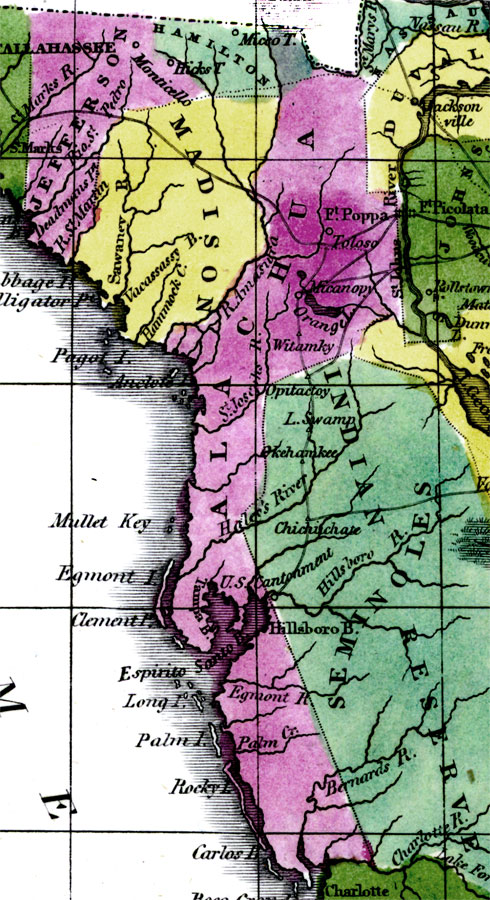
Description: Digitization provided by the USF Libraries Digitization Center. Rare Maps. This is a detail map of Alachua county circa 1834. Alachua county spanned from present day Baker county south to Sarasota county on the west coast. This map shows the Spanish Fort Poppa or Fort Puppa located on the west bank of the St. Johns River. This is one of two forts that was built to protect the Spanish settlers from the Indians while crossing the River. This map also shows the Amasura River which is present day Withlacoochee River.
Source: William Darby, Memoir on the geography and natural and civil history of Florida (Philadelphia, PA: Thomas H. Palmer, 1834)
Map Credit: Courtesy of the Special Collections Department, University of South Florida. |
|