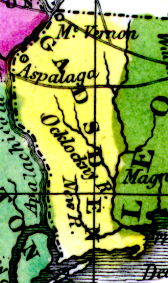
Description: Digitization provided by the USF Libraries Digitization Center. Rare Maps. This is a detail map of Gadsden county circa 1834. It shows important cities and towns of the time including Aspalaga, which was a Spanish mission. It also shows inland waters including the Ocklockny River which is presently known as the Ochlockonee River.
Source: William Darby, Memoir on the geography and natural and civil history of Florida (Philadelphia, PA: Thomas H. Palmer, 1834)
Map Credit: Courtesy of the Special Collections Department, University of South Florida. |
|