Title: Ramrod Key
Projection: Mercator,
Source Bounding Coordinates:
W: E: N: S: |
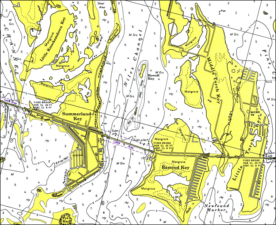
| | Description: A National Oceanic and Atmospheric Administration map of Ramrod Key including Summerland Key and Middle Torch Key, Florida, current to 1975. This Survey chart shows all soundings and heights expressed in feet. Obstructions such as shoals, submerged piles, fixed bridges and overhead cables are shown. The map scale is 1:40,000. Key to NOAA maps.
Source: National Oceanic and Atmospheric Administration, Bahia Honda Key to Sugarloaf Key (Washington, D.C.: U.S. Department of Commerce, 1975)
Map Credit: Courtesy the U.S. National Oceanic and Atmospheric Administration |
| |
|