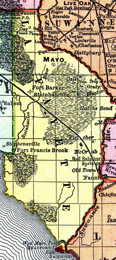
Description: Digitization provided by the USF Libraries Digitization Center. Rare Maps. This is a detail map of Lafayette county circa 1898. This map shows section township range (STR). Main cities and towns are shown such as the county seat Mayo. Inland waters are also shown such as the Steinhatchee and Suwannee Rivers. Scale: Statute Miles, 19 = 1 inch. Engraved, printed and published by Rand, McNally & Company.
Place Names: Lafayette, Mayo, Deadman's Bay, Pine Point, Gulf of Mexico, Fort Francis Brook, McCrab, Fannin, Old Town, Red Sulphur Springs, Fletcher, Mallory, Hatchs Bend, Branford, Grady, Steinhatchee, Fort Barker, Steinhatchee River, Call, New Troy, Day, Suwannee River, Brandford Springs, Hatchbend
ISO Topic Categories: inlandWaters, boundaries, transportation, oceans
Keywords: Lafayette County, physical, historical, political, transportation, physical features, county borders, railroads, inlandWaters, boundaries, transportation, oceans, Unknown,1898 AD
Source: Rand, McNally and Company, Rand, McNally and Company's Indexed atlas of the world. Florida. (Chicago, IL: Rand, McNally and Company, 1898) 311
Map Credit: Courtesy of the Special Collections Department, University of South Florida. |
|