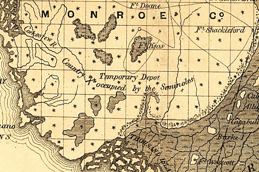
Description: Map of an area designated as Indian Territory taken from a 1859 railroad map of Florida. The area includes a portion of Monroe County northwest of the Everglades. Township grids based on the Tallahassee basis parallel and the Tallahassee prime meridian shows the extent of land survey in Florida along the coast in 1859 and the un-surveyed area of the Everglades. The map scale is 1:1,140,480.
Source: , Annual Report of the Surveyor General for 1859 (New York, NY: General Land Office, 1859)
Map Credit: Courtesy of the Geography and Map Division of the Library of Congress |
|